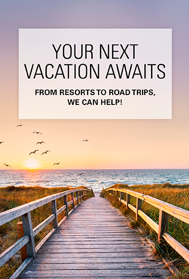
Take a Dozen Dazzling Trips with Stunning Views
You don’t have to be a back-country hiker, equestrian, rock climber or scientist to marvel at Washington’s spectacular vistas. Here are 12 of the state’s best drive-up viewpoints — plus a few other contenders — from mountaintops to downtown Spokane. All are accessible on good roads and no more than a short walk on pavement or an easy trail. (The author’s favorite six are marked with an asterisk.) Some are in state parks, which require a day-use ticket or an annual pass.

Hurricane Ridge, Port Angeles
The 330-mile Olympic Peninsula loop around the state’s northwest corner is one of the classic Washington road trips, worth two or three days at minimum. There’s plenty of access to the ocean, the Strait of Juan de Fuca and lush evergreen forests. But the best single place to see the majestic Olympic Mountains is about 20 miles south of Port Angeles on Hurricane Ridge, elevation 5,242 feet. From the parking lot and visitors center the mountains seem close enough to reach out and touch.
Mount Walker, Quilcene
From the summit of 2,804-foot Mount Walker, Hood Canal is below and the Kitsap Peninsula and Cascades are in the distance. On clear days, Mount Baker, Mount Rainier and even the Seattle skyline are visible. Go 5 miles south of Quilcene on U.S. Highway 101 to the Mount Walker turnoff, then 4 miles on a gravel road to the summit. Closed late fall to early spring.
Mount Constitution, Orcas Island
The best drive-up view of the San Juan Islands is from the top of Mount Constitution on Orcas Island, one of four islands served by state ferries from Anacortes. Accessed from Moran State Park at the opposite end of the island from the ferry landing, it’s the highest point in the San Juans at 2,398 feet. A paved, winding road climbs 4.7 miles to the summit with views to Vancouver Island, B.C., Bellingham, Mount Baker, the North Cascades and other islands. A stone watchtower at the viewpoint, built during the Great Depression by the Civilian Conservation Corps, offers enhanced views.

North Cascades*
The view-rich North Cascades Highway (state Route 20) runs 136 miles from Sedro-Woolley in the west to Twisp. Completed in 1972, it bisects North Cascades National Park. Two viewpoints are especially dramatic. Diablo Lake, about 70 miles east of Sedro-Woolley, is the color of turquoise due to sunlight refracting off rock particles in the water washed down by glaciers. Thirty-four miles farther southeast, Washington Pass Observation Siteoffers a stunning view of the winding highway and the iconic Liberty Bell Mountain. This requires a walk of about a quarter-mile on a smooth, wheelchair-accessible path.
Deception Pass State Park, Whidbey Island
The Deception Pass Bridge carries state Highway 20 from the north end of Whidbey Island to Fidalgo Island and Anacortes, then to I-5 at Burlington and the North Cascades Highway. This regal Depression-era span is widely considered Washington’s most photogenic highway bridge. Park immediately south of the bridge and walk onto the span for views out to Lopez and other islands. Some 190 feet down boats fight some of the fastest and trickiest currents in Puget Sound. Once you have admired the view, drive south to the first stoplight and turn down to West Beach for water-level sunset views from your car. Walk north along the sand for two or three minutes and admire that beautiful bridge from below.
Snoqualmie Falls
Shortly after the three forks of the Snoqualmie merge near North Bend the roaring river plunges over 269-foot-high,100-foot-wide Snoqualmie Falls. The sight is impressive and free, but also unusual for its proximity to Seattle. Bellevue is only 23 miles away. From Exit 25 on Interstate 90 head north 4.3 miles on Snoqualmie Parkway.
Sunrise Visitors Center,* Mount Rainier National Park
The highest point reachable by car in Mount Rainier National Park is Sunrise Visitors Center at 6,400 feet, which is typically open early July to mid-September. Reachable from the White River Entrance via state Route 410 from Enumclaw or over Chinook Pass from Yakima, Sunrise offers spectacular close-up views of Rainier’s glaciers. Several trails fan out from the visitors center with even better views. Be sure to stop at Sunrise Point, 2.7 miles short of the visitors center, for sweeping vistas of mountains and canyons.

Mount St. Helens volcano,* Southwest Washington
This is one of the state’s iconic “gotta-see” sights. From Interstate 5 Exit 49 at Castle Rock, it’s a vista-rich 52-mile drive on state Route 504 to the visitors center at the Johnston Ridge Observatory. (Alternatively, from the north, take Winlock-Toledo Exit 63 and state Route 505.) You’ll look straight into the gaping crater created by the 1980 volcanic eruption that claimed 57 lives and took 1,300 feet off the top, cutting its elevation to 8,365 feet. There’s plenty to see inside and a food truck in the parking lot.
Cape Horn
The lofty view up the Columbia River from Cape Horn, 9 miles east of Washougal, is a “keeper.” It’s a rare sight in these parts because so much of Washington Highway 14 — as well as Interstate 84 on the Oregon side — is only slightly above river level or blocked from the river by trees. From this point 690 feet above the Columbia you can see Beacon Rock and beyond. Unfortunately, there’s room for only four or five cars in the pull-off. Whether stopping or passing, slow down and use caution.
Dry Falls,* Coulee City-Ephrata
Vast swaths of Eastern Washington that were carved, gouged and re-arranged by dozens of ice age Missoula Floods 13,000–16,000 years ago are best seen today from the air. But probably the most impressive drive-up spot to grasp what the catastrophic floods wrought is at the Dry Falls State Park Visitors Center. Floodwaters from the north roared over the 400-foot-high, 3.5-mile-wide cliff, almost five times the average width of Niagara Falls. It’s dry today but thought to have been the greatest waterfall in the history of the world. Dry Falls is 25 miles north of Ephrata on state Route 17 and 4 miles from Coulee City south of U.S. Highway 2 on state Route 17.

Palouse Falls,* Southeast Washington
Washington’s official state waterfall wasn’t always here and the Palouse River does not fall from a mountain like most waterfalls. In this unusual but spectacular setting at Palouse Falls State Park, viewers look down on the river as it emerges from low rolling farmland and plunges 200 feet down a basalt cliff into a pool then disappears into a narrow canyon toward the Snake River. Before the ice age Missoula Floods, the river’s course was several miles north to the Columbia River. Go south from Interstate 90 at Ritzville or north from Pasco on U.S. 395 to Connell, then east 31 miles on state Route 260 through Kahlotus and south 9 miles on state Route 261 and left on Palouse Falls Road.
Riverfront Park and Falls,* Spokane
Yes, that’s an actual waterfall in downtown’s Riverfront Park where the Spokane River flows on its 111-mile route from Lake Coeur d’Alene, Idaho, to the Columbia River. There’s much to see and do in the park on this site of the 1974 World’s Fair. For the best view, take a ride in one of the enclosed gondola cars overhead. These are the star of the show on their 15-minute round trip with a 200-foot drop and regain. Several parking lots are nearby.

Other Great Viewpoints
Columbia River and Wild Horse statues — Hard-charging metal ponies above and Columbia River and Wanapum Dam below. I-90 Exit 139, 1 mile east of Vantage Bridge.
Coulee and climbers — Frenchman Coulee, gaping, dry and eerie, stretches toward the Columbia River and The Feathers basalt spires, a beehive of rock-climbing activity. Four miles from I-90 on Exit 143 (Silica Road) west of the town of George, Washington.
Grand Coulee Dam — Iconic North Central Washington dam’s massive spillway and nighttime laser light show. There’s outdoor viewing at the visitors center, the bridge a half-mile downstream and Crown Point 11 miles up to the west via Highway 174.
Kerry Park — See downtown Seattle, bustling Elliott Bay and Mount Rainier (on a clear day) from the park and esplanade. Second Avenue West and West Highland Drive on Queen Anne Hill.
Manastash Ridge — Verdant Kittitas Valley, Ellensburg and the Cascade Range. On I-82/U.S. 97, 7 miles south of I-90 and 24 miles north of Yakima.
Mount Erie — Rosario Strait, several islands and the Cascades, including Baker and Rainier on a clear day. Three miles south of downtown Anacortes.
Mounts Shuksan and Baker — Much-photographed Picture Lake, with 9,131-foot Mount Shuksan, and Artist Point with 10,781-foot Mount Baker. End of state Highway 542 about 56 miles east of Bellingham.
—Written by Gregg Herrington
—Top photo overlooking the Columbia Gorge is by Gary L. Quay/AdobeStock.
Road Trip Tips
Before you go: Get ready for your road trip with a AAA Membership. Get peace-of-mind on the road plus travel and insurance services and much more.
Save on hotels and rental cars: Unlock savings on hotels with a AAA membership. Plus, AAA members save up to 20% with Hertz.
Save on car insurance: AAA members save up to 8% on car insurance.
Get battery service: AAA Mobile Battery Service uses state-of-the-art technology to accurately diagnose battery-related problems. We’ll even replace your battery with a brand-new one if necessary, at a special member price.
Save with AAA member discounts: AAA membership gives you access to exclusive entertainment discounts nationwide.