Hit the Road to Experience the Evergreen State’s Limitless Beauty
From the glacier-clad peaks of the North Cascades to the crashing blue waves near the mouth of the Columbia River, Washington state has spectacular vistas around every corner. Some roadways take scenic viewing to a new level, however. Here are nine driving routes that show off the state’s varied natural beauty and will make you want to get out and go.
Yakima Scenic Byway
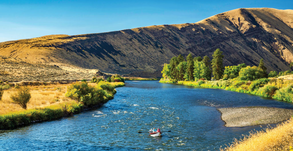
Located in the rugged terrain of central Washington, the Yakima Scenic Byway (U.S. Route 97) traverses the sweeping lands of the Yakama Nation Reservation, east of the Cascade mountains. It then continues into fertile Klickitat Valley, where lush farms await. The 58-mile route starts in Toppenish — a town filled with dozens of murals showcasing life in the West — before passing through the vast
expanses of the lower Yakima Valley and ascending into the Simcoe Mountains. Keep an eye out for herds of wild horses in the area approaching 3,107-foot-high Satus Pass, which connects the two valleys. The route continues to Goldendale, the largest city in Klickitat County as well as the county seat, north of the Columbia River.
Hood Canal Scenic Route
Superb views of the Olympic Mountains and blue water await on this scenic drive around the southern banks of Hood Canal, a natural fjord separating the Kitsap and Olympic peninsulas. For those with limited time, state Route 106 is a perfect choice. At roughly 20 miles, the route can be driven in around half an hour, following the shoreline of Hood Canal on the Kitsap Peninsula.
The highway winds past the moss-draped forest of Twanoh State Park, a seasonal campsite of the Skokomish/Twana people, where oysters and clams are plentiful in the park’s warm saltwater. Grab a license for harvesting and check for potential closures when planning your trip. From here the roadway continues toward the small community of Belfair and its Mary E. Theler Wetlands Nature Preserve, where brightly colored kingfishers, herons and Canada geese feed among the salt marshes and wetlands.
Chinook Pass Scenic Byway
Journey through mountainous meadows and forests of lodgepole pine and Douglas fir, enjoying breathtaking views of snow-capped Mount Rainier. From the west, the 82-mile route extends from Enumclaw to the Naches valley over the 5,430-foot Chinook Pass. The pass itself is located at the east entrance of Mount Rainier National Park. The byway (state Route 410) traces part of the historic Naches Trail, a former wagon route that Indigenous Americans created for their use centuries ago. With the White River on one side and the slopes of Crystal Mountain — Washington’s largest ski resort — on the other, the route ascends toward the byway’s namesake pass.
Chinook Pass is awash in vibrant shades of amber, orange and gold in autumn, but
the views are stunning on a clear day in any season. Take in the picture-perfect beauty of Tipsoo Lake. The pass is typically open from around Memorial Day until mid-November.
Chuckanut Drive Scenic Byway
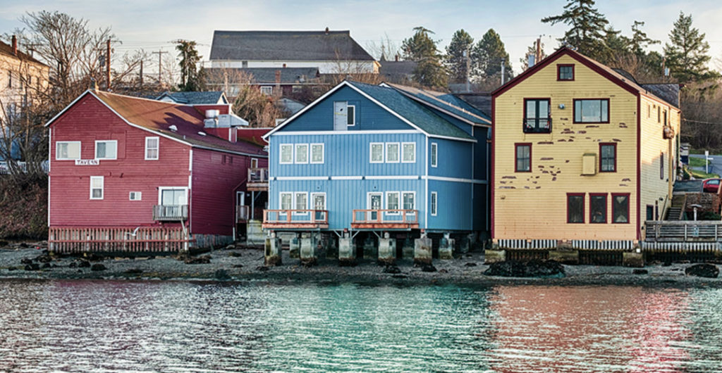
An iconic 21.2-mile route, state Route 11 runs from Burlington to Bellingham in the northwest corner of the state. In the northern leg of the trip, the curvy road hugs the coast of Samish Bay on one side and the sandstone cliffs of Chuckanut Mountain on the other. The route then opens to the bountiful agricultural soil of Skagit County — which is awash in fields of blooming tulips for a brief period each spring.
At one point, the road passes through Larrabee State Park, known for its shoreline of pebbly beaches, tidal flats and tide pools. The two-lane byway then proceeds through peaceful farming communities before ending its journey near Burlington, about 60 miles north of Seattle. A stop for oysters (raw, fried or baked) on this trip is almost a must.
Whidbey Scenic Isle Way
This 49.6-mile scenic route along state Route 525/20 journeys through the heart of Washington’s largest island, reached via a short ferry ride across Puget Sound from the Mukilteo terminal near Everett. The road travels among open prairies and farmlands, and forests filled with grand fir, Sitka spruce and shore pine trees. The view occasionally opens to reveal mountains to both the east and west.
Charming seaside towns and waterfront farming communities dot the landscape, such as one of Washington’s oldest communities, Coupeville, with its century-old buildings. Your trip culminates at the 3,854-acre Deception Pass State Park. Here, expect to see mesmerizing sunsets, rugged cliffs and ample saltwater shoreline, not to mention one of the state’s most iconic bridges.
North Coulee Corridor Scenic Byway
On one end of this 28.4-mile scenic byway (state Route 155) in the arid rolling plains of north-central Washington stands a civil engineering wonder — the colossal Grand Coulee Dam. On the other end is Coulee City, a hub for boaters, hikers and birdwatchers. Between them is Banks Lake, a reservoir that fills the northern portion of the Grand Coulee. This natural ravine was formed by glacial floods 18,000 to 13,000 years ago.
Today, towering basalt rock rises on both sides of the azure lake. Its tranquil waters are popular with swimmers and stand-up paddleboarders. Along the way you’ll encounter Steamboat Rock State Park, teeming with sagebrush and wildflowers each spring. The hike up its namesake butte is worth the 650-foot vertical climb. The trail flattens out at the top, providing views of Grand Coulee and the peaks of the Okanogan-Wenatchee National Forest.
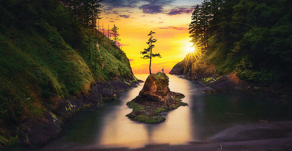
Pacific Coast Scenic Byway, Southwest Washington
Along the southwest Washington coast, the Pacific Coast Scenic Byway is a 28.8-mile segment of the classic highway route (U.S. 101) from Washington to California. The tour starts at the northern end of the Astoria-Megler Bridge on the Columbia River, the longest continuous-truss bridge in North America. It then proceeds past the more than 116-year-old coastal defenses of Fort Columbia Historical State Park toward Long Beach Peninsula.
Once on the peninsula, the route passes near Cape Disappointment State Park, a 2,023-acre coastal camping park. It is worth a detour to check out the 123-year-old North Head Lighthouse perched on a cliff overlooking the treacherous confluence of the Columbia River and the Pacific, a spot known as the “Graveyard of the Pacific” for the many shipwrecks there.
On the southern end of Long Beach Peninsula, you will also encounter seaside communities where oysters and cranberries thrive, before turning inland toward Willapa National Wildlife Refuge — a land of coastal dunes, salt marshes and old-growth forests. In the waters of Willapa Bay, which often recede to reveal miles of mudflats, stands Long Island itself. As you continue, keep an eye out for the great blue herons, Roosevelt elk and black bear that call this landscape home.
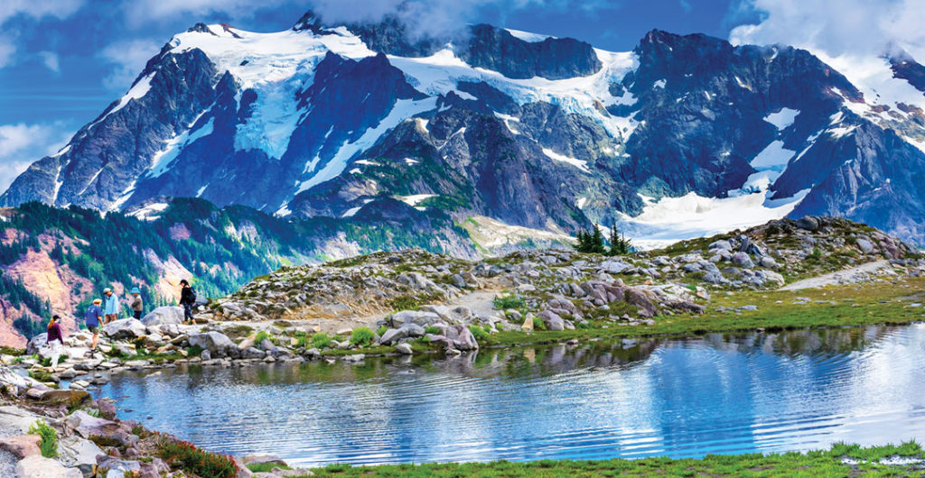
Mount Baker Scenic Highway
Beginning just east of the town of Glacier near the Canadian border, stunning state Route 542 winds its way up Mount Baker for roughly 24 miles until eventually reaching Artist Point at 5,100 feet elevation. The road ascends through forests of hemlock and fir trees and soon curves its way alongside andesite columns resulting from lava flows. In colder months, bald eagles swoop down from the skies to pounce on salmon swimming in the North Fork of the Nooksack River.
Ascend past the slopes of the Mount Baker Ski Area (where the route ends in winter), and upward toward Heather Meadows, where the color bursts in the summer from heather and huckleberries in full bloom. Once at the terminus, Artist Point provides spectacular 360-degree views of the North Cascades, including both Mount Baker and Mount Shuksan, known for its rugged, glaciated beauty. Note that the higher sections of this road are typically closed from mid-October until the snowpack melts in June or July. So, check ahead.
Windy Ridge Scenic Highway
The colossal power of Mount St. Helens is on full display at Windy Ridge just five miles from the volcano. This is the culminating point of a 16-mile drive along Forest Road 99 that climbs through the old-growth woodlands and volcanic peaks of Gifford Pinchot National Forest. At the Windy Ridge interpretive site, visitors have a panoramic view of a landscape that was radically altered by the 1980 eruption.
For a higher view, you can climb up a 368-step sand ladder. Along the way, the road ascends past Bear Meadow, where campers captured some of the most devastating photos of the eruption. You will then reach Meta Lake, a small lake that was protected from total destruction that year by a heavy snowpack. Pacific tree frogs and other amphibians still thrive there. Several interpretive sites highlight Mount St. Helens’ monumental and cataclysmic eruption along the route. Forest roads in the park are typically closed between November and mid-summer, so check with the Forest Service before setting out.
–Written by Laura Kiniry, last updated in September 2022.
–This article originally appeared in the July 2021 Edition of AAA Washington’s member magazine, Journey.

Road Trip Tips
Before you go: Get ready for your road trip with a AAA Membership. Get peace-of-mind on the road plus travel and insurance services and much more.
Save on hotels and rental cars: Unlock savings on hotels with a AAA membership. Plus, AAA members save up to 20% with Hertz.
Save on car insurance: AAA members save up to 8% on car insurance.
Get battery service: AAA Mobile Battery Service uses state-of-the-art technology to accurately diagnose battery-related problems. We’ll even replace your battery with a brand-new one if necessary, at a special member price.
Save with AAA member discounts: AAA membership gives you access to exclusive entertainment discounts nationwide.

