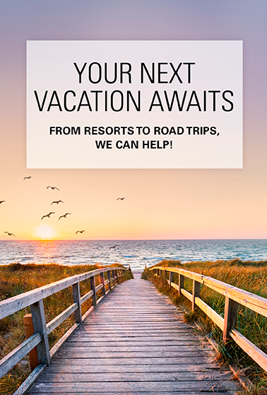
Spectacular Scenery and Unique Attractions Await Motorists Crossing the Cascade Range
Late summer to early fall is the perfect time to discover — or rediscover — one or more of Washington’s six stunning highway routes over and through the Cascade Range. Post-Labor Day traffic is often lighter, crowds are thinner, colors are more varied, and some inns and tourism-dependent shops might be trimming prices.
These six routes include federal and state scenic byways, two routes through or abutting national parks, one through the country’s largest national scenic area, and one that we’ll call “The Pass That’s Hiding in Plain Sight.”
All six expose motorists to an awesome variety of landscapes, climates, foliage and geology. Snow forces closure of two routes (North Cascades and Chinook Pass) every fall, but rarely before November. In addition, roadside attractions and side-trip possibilities include the state’s oldest continuously operating saloon, an interpretive site describing the state’s single most-deadly event 111 years ago, Bavarian and Old West theme towns, the highest paved road in the state, countless short-hike options, eye-popping viewpoints and a few good bakeries.
From north to south, here are Washington’s six cross-state highway routes.

North Cascades: National Scenic Highway (State Route 20)
This youngest and longest of the six routes is also the most spectacular. Abutting North Cascades National Park and including two of the state’s highest highway passes, it offers views of jagged peaks and spires, glaciers, waterfalls and lakes. Campgrounds and a multitude of trailheads are adjacent or close to the highway. The route is bookended by pastoral valleys of the Skagit River to the west and the Methow River to the east.
Gateways: Burlington to the west is 133 miles west of Winthrop to the east.
Elevation/closures: Rainy Pass, 4,875 feet and Washington Pass, 5,477 feet; closed late fall to mid-spring
Daily Traffic: 1,400 vehicles, 8% of which are trucks
Year opened: 1972, four years after North Cascades National Park was established
Worth a stop: Farm-fresh produce stands in Skagit Valley and Methow Valley; Silo Park in the historic town of Concrete, 29 miles east of Burlington, where cement was once made from clay and limestone; North Cascades National Park Visitors Center in Newhalem; numerous viewpoints, including Lake Diablo, Ross Lake and Washington Pass overlooks; Old West theme town of Winthrop; Cinnamon Twisp Bakery in Twisp.

Stevens Pass: National Scenic Byway (U.S. Highway 2)
Eastbound from Monroe, the highway passes through rural countryside, small towns and past 5,991-foot Mount Index, the rocky promontory signaling that the climbing is about to begin. The highway accompanies the Skykomish River through lush evergreen forests up and past the Stevens Pass ski area to the dry side of the state.
Nason Creek and the Wenatchee River play peekaboo with motorists on the eastern slope. The most spectacular whitewater views are along the Wenatchee River in Tumwater Canyon, just west of Leavenworth. The highway is two lanes most of the way.
Gateways: From Monroe it’s 85 miles southeast to Leavenworth and another 22 miles to Wenatchee.
Elevation/closures: 4,061 feet at Stevens Pass; route open year-round with possible temporary winter closures to clear snow
Daily traffic: 5,000 vehicles, 6% of which are trucks
Year opened: 1925, replacing a series of wagon roads dating to the late 1800s
Worth a stop: The Sultan Bakery on Highway 2 in Sultan, 7 miles east of Monroe; Iron Goat Trail rest area and interpretive center, 9 miles east of Skykomish on the north side of the highway; Kiosks describe the 1910 Wellington Disaster when a massive avalanche killed 96 people sleeping in two snowbound trains. It remains the state’s deadliest natural disaster; the nostalgic 59er Diner at Cole’s Corner, 20 miles east of Stevens Pass at the State Route 207 turnoff to Lake Wenatchee State Park; Bavarian-themed town of Leavenworth, 35 miles east of the pass; the longest railroad tunnel in the nation, 7.8 miles under Stevens Pass, built in 1929 by the Great Northern Railway (sharp-eyed motorists might catch a fleeting glance at the tunnel’s portals at either end); and the Sure-to-Rise Bakery on Cottage Avenue in Cashmere, between Leavenworth and Wenatchee.

Snoqualmie Pass: Mountains to Sound Greenway (I-90)
This is the lowest, widest and busiest of the five passes over the Cascades. Eastbound, after Seattle, Bellevue and Issaquah, I-90 passes 4,167-foot Mount Si just north of North Bend and begins climbing along the South Fork of the Snoqualmie River. The route is especially dramatic as it approaches the summit. Glance to the left across a wide, deep canyon and see the westbound lanes on the elevated highway. East of the summit and its ski area, blasting and widening for avalanche mitigation and road construction is cause for occasional delays. On one side are steep cliffs; on the other is Lake Keechelus, headwaters of the Yakima River. Eight miles east of the summit, a wildlife overpass provides a safe route for critters, large and small, to reach the lake.
Gateways: Seattle at I-5 or North Bend, 30 miles up the freeway, are western entrances; Cle Elum, 83 miles from Seattle, is the eastern entrance and the southern gateway to Blewett Pass on U.S. 97, north to Leavenworth and Wenatchee.
Elevation/closures: 3,022 feet at Snoqualmie Pass; open yearround, with temporary closures or delays due to avalanche control or construction
Daily traffic: 34,000 vehicles, 20% of which are trucks
Year opened: 1867, first wagon road, Seattle to Ellensburg; 1905, first automobile over the pass; 1915, two-lane Sunset Highway
Worth a stop: Franklin Falls, an easy, 2-mile round-trip hike off Exit 47 (Denny Creek/Tinkham Road); Historic Roslyn, about 3 miles northwest of Cle Elum on state Route 903, is a former coal-mining town made famous as location for the 1990s TV series Northern Exposure. Its Brick Saloon is reputedly the state’s oldest continuously operating bar. The Roslyn Cafe, with the iconic camel mural on the outside, features heaping burgers and sandwiches. In laid-back Cle Elum, the Pioneer Coffee Roasting Co. and the Cle Elum Bakery are local favorites.

Chinook Paas: Scenic Byway (State Route 410)
Linking Yakima and Enumclaw, Chinook is the second-highest and, arguably, the second-most scenic of Washington’s crossstate passes. With its western approach far from a major highway or big city, Chinook Pass has the lowest average daily traffic count of the six east-west routes. It’s “The Pass That’s Hiding in Plain Sight.”
From Enumclaw, SR 410 runs east 19 miles along the White River to the small community of Greenwater (population 67), the last chance for food and fuel over the mountains. The highway climbs gradually for several more miles before getting steep, with switchbacks, to Chinook Pass at 5,430 feet.
At the pass, the Mexico-to-Canada Pacific Crest Trail crosses the highway on an iconic log footbridge. Pull over and take in the view to the east of the vast American River drainage. The highway is visible hugging the valley wall on its way 51 miles down to Naches and another 15 to Yakima.
Although SR 410 is inside Mount Rainier National Park for a few miles, there is no fee. Park admission is collected just off the highway at the White River entrance, 39 miles from Enumclaw and 8 miles short of Chinook Pass. From that entry, it’s 14 miles and several switchbacks to the Sunrise Visitors Center on the state’s highest paved road at 6,400 feet. A mile short of Sunrise is a viewpoint offering grand vistas in several directions.
Gateways: Enumclaw to the west and Yakima, 111 miles away, to the southeast
Elevation/closures: 5,430 feet at Chinook Pass, which typically is closed from mid-November to late spring
Daily traffic: 1,200 vehicles, 4% of which are trucks
Year opened: 1931
Worth a stop: Greenwater; Crystal Mountain Ski Resort has summer chair lifts and gondola, a restaurant and hiking; Tipsoo Lake, for photographs; the easy 3.5-mile Naches Peak Loop Trail, with wildflowers and views of Rainier (clockwise is best).

White Pass: Scenic Byway (U.S. 12)
This route over the mountains is third highest of Washington’s Cascade passes and the only one open year-round between the Columbia River Gorge and I-90 over Snoqualmie Pass.
From the west, the route offers access to several popular destinations: Mayfield and Riffe lakes on the Cowlitz River, Mount Rainier’s Paradise Inn and the Henry M. Jackson Visitor Center and hiking not far from Highway 12. Southbound from Randle, Forest Service Road 25 takes you to the Windy Ridge Interpretive Site and features awesome views of Mount St. Helens and the destruction from its 1980 eruption. From Randle or Packwood, travel south for trail access into the Goat Rocks Wilderness — one of the most beautiful areas the Pacific Crest Trail traverses — and farther south to the Mount Adams Wilderness. State Route 123, 7 miles east of Packwood, heads north over Cayuse Pass, except during snow season, to Highway 410.
Gateways: From the west, Interstate 5 south of Chehalis to Highway 12; from the east, Interstate 82 from Yakima to Naches
Elevation/closures: 4,500 feet; open year-round with potential temporary closures
Daily traffic: 1,700, 30% of which are trucks
Year opened: 1931, Packwood to Naches, total route opened in 1951
Worth a stop: Morton, rich in logging history and just 30 miles from the main entrance to Mount Rainier National Park; Mountain Goat Coffee and Bakery in Packwood; monster trees in the Grove of the Patriarchs near the Ohanapecosh Campground; various viewpoints along Highway 12, including the fascinating Palisades Overlook 10 miles east of Packwood

Columbia River Gorge: National Scenic Area (State Route 14)
The 90-mile route on Highway 14 through — not over — the Cascade Range is the lowest and most varied of the six cross-state highways. From east to west, the changes are striking in climate, vegetation, geology, topography and wildlife.
The Gorge is one of only nine National Scenic Areas in the country, a designation established in 1986. The landscape varies from lowlands around Washougal to the west, to the Cascades towering above the highway through the heart of the Gorge (with major waterfalls on the Oregon side), to low, rolling hills, exposed layers of basalt and vineyards to the east.
Geologists study the Gorge for what it reveals about the forces of nature over eons and as recently as the ice-age Missoula Floods 15,000 to 18,000 years ago. The Columbia’s course has shifted here and there, but the river was there before the Cascade Range.
Gateways: Washougal to the west and the small community of Maryhill 90 miles east at the junction with U.S. Highway 97
Elevation/closures: Generally less than 300 feet with some temporary winter closures, mostly in the western half of the Gorge
Daily traffic: 3,500 vehicles, 16% of which are trucks
Year opened: 1905, Washougal to Lyle; 1913, extended to Maryhill; 1949, extended to Kennewick
Worth a stop: Various viewpoints, including Cape Horn Lookout about 25 miles east of I-5 in Vancouver with a sweeping view upriver; hiking trails on both sides of the Columbia, including Beacon Rock State Park on the Washington side, where a “trail” of steps leads to the top of the 848-foot-high rock; towns of Stevenson, Bingen or Lyle for food or fuel; Maryhill Winery on the bluff overlooking the Columbia, between the community of Wishram and U.S. 97
Before heading out on Washington highways, especially over the passes, check for delays, detours and closures at wsdot.com.
– Written by Gregg Herrington