3 Not-to-Miss Stops North of Washington’s Most Iconic Mountain
Many visitors begin exploring the mountain at the subalpine wonderland of Paradise, but the Mount Rainier National Park has even more incredible areas to explore.
In 1899, President William McKinley designated Mount Rainier as the country’s fifth national park. Towering 14,410 feet above sea level, the mountain is the highest volcanic peak in the contiguous United States, making it among America’s most visible national parks.
On the Northwest corner of Mount Rainier National Park, the Mowich Lake and Carbon River regions are for those looking for the wild and rugged outdoors. Disconnected from the amenities and main roads around the park, a visit here gives quick access to wilderness splendor. Reaching Mowich and Carbon is an adventure in itself, passing through the old town of Carbonado before crossing over the Carbon River on the Fairfax Bridge, a steel-latticed arch bridge built in 1921 that will dazzle those who find their way over the scenic span of pavement. Past the bridge, two choices emerge: Follow the river to the Carbon River entrance or head up to Mowich Lake.
The Carbon
Carbon River is accessible year-round via state Route 165 through Wilkeson and is the closest park entrance to visitors from the Seattle area. Vehicles can travel only as far as the parking lot at the park entrance, which is close to a ranger station that is generally open year-round. Beyond the entrance, the road is open to bicyclists and hikers year-round, and visitors will find multi-use trails that are mostly easy and flat.
The Carbon River Rainforest Nature Trail is an easy-to-follow educational trail, weaving around through the forest in just over a half-mile round trip. Rainforests seldom occur far from coastal areas, making the lush growth at Carbon River unique.
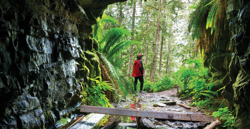
The Carbon River Trail is another great option, following an old roadbed 5 miles to the Ipsut Creek Campground. This section of road is also bike-friendly, leaving visitors in awe under huge old-growth timber. From the campground, it is a short hike to Ipsut Falls. Backpackers and long-distance hikers can continue on past the campground to the Carbon Glacier and the Wonderland Trail.
There also are fun side adventures from the Carbon River Trail. The Old Mine Trail is a good, but sometimes steep, 2.9-mile round-trip excursion that leads to an old mineshaft among old growth red cedars and Douglas firs. Closer to Ipsut Creek Campground, hikers looking for a bit more of a challenge can head up to Green Lake or Chenuis Falls.
Mowich
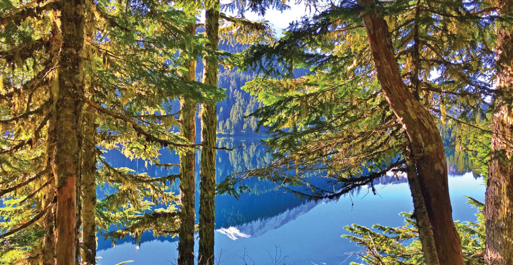
Just under 5,000 feet above sea level, Mowich Lake is the largest and deepest lake in Mount Rainier National Park. An overlooked gem for the roughly 2 million visitors who explore the park annually, this area is a high-elevation forest wonderland. The bumpy, gravel Mowich Lake Road typically opens by mid-July and closes by mid-October, keeping Mowich a less-visited region.
Mowich does not have the amenities of Sunrise or Paradise. The Mowich Lake Campground is no-frills. The walk-in campground is tent-only and available to visitors on a first-come, first-served basis. There are just 10 spots, and fires are prohibited. There is no potable water and a vault toilet.
What brings people to Mowich is the quick access to the Wonderland Trail and the wilderness of Rainier. The classic trek into Spray Park rewards hikers with wildflowers, cascading falls, wildlife sightings and views of the mountain. Experienced adventurers can trek to glaciers and enjoy the views from Echo Rock and Observation Rock.
Tolmie Peak is another highly regarded trail, giving sweeping views of the mountain from a lookout tower perched over Eunice Lake. The wildflowers around Mowich typically bloom around late July or August, while the fall colors start popping in late September. Although the hiking window may be short, getting here is a must.
Sunrise
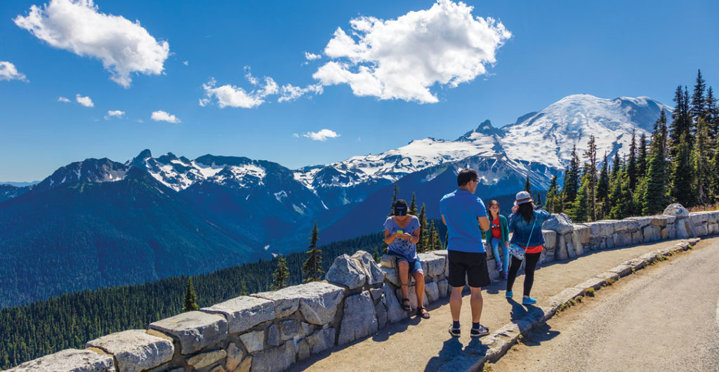
Reached by navigating hairpin curves up the paved road from White River, Sunrise is the park’s second-most visited region and is the highest point in the park reached by vehicle at 6,400 feet above sea level. The Sunrise Park Road usually opens in late June or early July. The drive from White River provides jaw-dropping views of the Cascades, reaching a crescendo at Sunrise Point.
Sunrise Point gives a panoramic view of the region, including an up-close glimpse of Rainier, as well as commanding views of Mount Adams and the Cascade Range. Scan the hillsides here to see elk, mountain goats and black bear. The busy parking area at the point is not suitable for oversized vehicles like RVs. Although this spot may be called Sunrise, catch a sunset here and stay out until the Milky Way galaxy is overhead. During the day, hikers looking to expand the views of Sunrise Point can head up to Dege Peak, a 4.2-mile round-trip hike from the Sunrise Visitor Center.
On a sunny day, gaze at the mountain and look right at Emmons Glacier, the largest glacier by surface area in the contiguous United States. Branching out from the parking area at Sunrise, near the visitor center and a day lodge, various levels of hiking options are available, giving every style of visitor a chance to enjoy the majesty of the mountain.
The Burroughs is another favorite hiking option that is accessible from Sunrise. At more than 7,800 feet, Burroughs Mountain is located on the northeastern face of Mount Rainier, abutting Winthrop Glacier. There is also a lookout tower here, reached by the strenuous Mount Fremont Lookout Trail. Hikers can set out for multiple destinations that vary in length and elevation gain. Easier treks for all ages are the Sunrise Nature Trail and the Silver Forest Trail.
For a limited amount of time every year, Sunrise is also a great place to witness Mount Rainier’s renowned wildflowers. The peak bloom for wildflowers is heavily dependent on weather and precipitation patterns. In most years, many flowers will bloom by mid-July. While exploring the park, visitors should stay on the trails to keep from damaging the fragile meadow ecosystem where these beautiful flowers grow. By the time the road closes in late September to early October, snow will already be dusting the ridges.
– Written by Douglas Scott, last updated in September 2022.


