5 Great Trails Between Manzanita and Coos Bay
If you like hiking in the Northwest, you probably already know about the particularly sweet spot on the calendar called fall, when the weather is reliably pleasant, the summer crowds have dissipated and the deciduous trees get showy. On the Oregon coast, you get the added bonus of gorgeous ocean views made even more enticing by the chance to glimpse resident gray whales through September. For many, the coast and nearby sections of Oregon’s coastal range provide the hiking highlights of the year in autumn. Here are a few favorites.
Neahkahnie Mountain
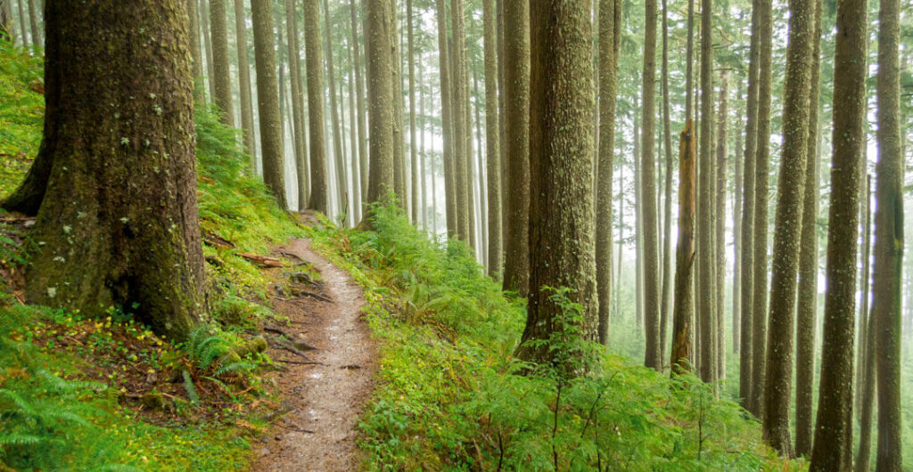
Located in Oswald West State Park, Neahkahnie Mountain is a true gem. Two different trailheads start off on two vastly different hikes; both culminating at the same life-affirming lookout over Nehalem Bay. You’ll experience a more traditional coastal forest on the north side—old-growth Sitka spruce and western red cedar, emerald green moss and carpets of almost fluorescent oxalis. The south side offers a drier, more sun-drenched hiking path that explores open meadows before entering the woods for a final push to the top.
Four miles out and back from the North Trailhead to the summit, or 3 miles out and back from the South Trailhead.
Cape Lookout
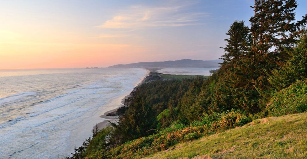
For outdoor lovers, Cape Lookout State Park is without a doubt one of the crown jewels of Tillamook County. The park is a well-known haven for camping, fishing, beach strolling and even hang gliding. But the headliner is the Cape Lookout hike, which stretches along the length of the cape itself, reaching 2 miles out into the Pacific Ocean. The path meanders through some of the best old-growth forest in the county, with majestic trees guarding the path on either side for nearly 2 miles.
For the final stretch, the trail exits the canopy and skirts along dramatic cliff-edge viewpoints on either side of the cape—each seemingly better than the last. The trail ends at a bench on the tip of the cape. On a clear autumn day, the view of the coastline to the south extends seemingly forever. Keep an eye trained on the waters below, however, as there are few places better suited for spotting resident gray whales than from this high perch.
The moderate Cape Lookout hike is 4.8 miles out and back to the end of the cape, with 930 feet of elevation gain. The Cape Lookout South Trail, 3.6 miles round-trip, leads down to a lightly visited beach and back, with 840 feet of elevation change.
Cascade Head
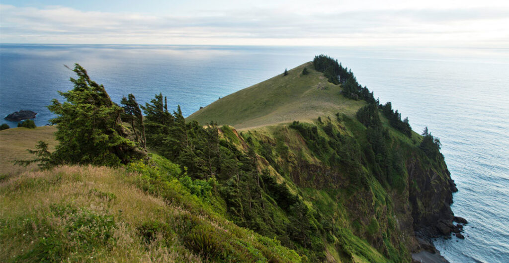
The hike to the top of Cascade Head is strenuous. But the rewards far outweigh the price of burning thighs. If you’re the type of hiker who enjoys exemplary Pacific Northwest forest, sweeping coastal views and rare ecosystems, then it’s a hike that should be at the very top of your must-do list. The initial ascent gains elevation greedily through a forest of Douglas fir, spruce and alder before emerging into a vast meadow with immediate views of the Salmon River estuary and Lincoln City in the distance to the south.
Cascade Head provides critical habitat for native prairie grasses and rare plants, including 99% of the world’s population of Cascade Head catchfly. It also provides a home for the threatened Oregon silverspot butterfly. The scenery gets commensurately better all the way to the summit. From there, you can catch your breath while taking in views of the ocean, delicate rolling meadows and the Salmon River, rounding the final bend on its journey to the Pacific.
A difficult 6.8-mile round-trip with 1,300 feet of elevation gain; or 2 miles out to the summit meadow and back via the Upper Trailhead. The Upper Trailhead is closed from Jan. 1 to July 15 to protect delicate habitat and wildlife. Dogs, even when leashed, are not allowed on the trails at Cascade Head.
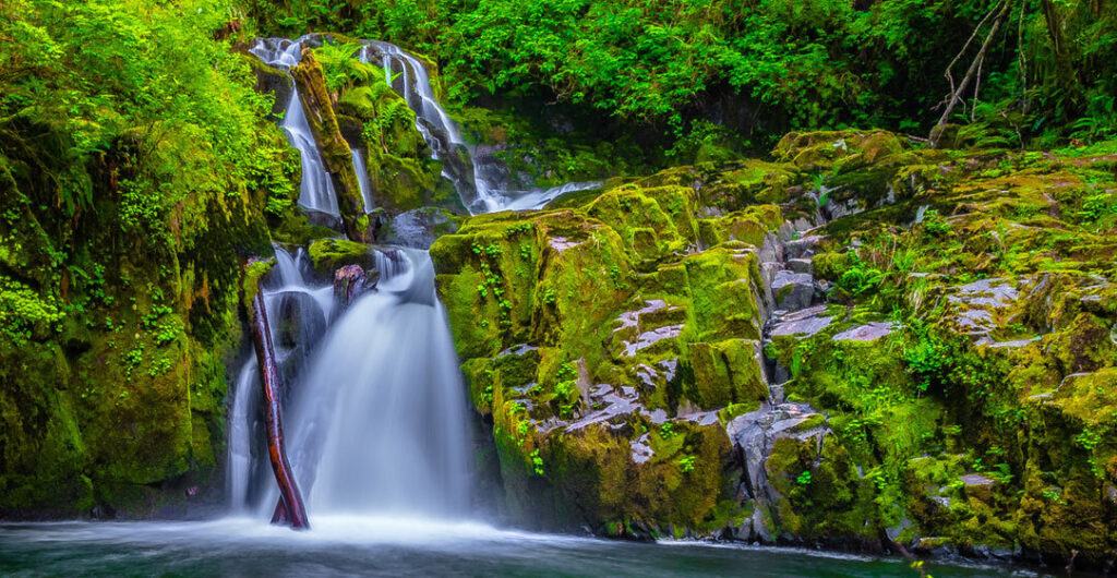
Sweet Creek Falls
There are no long-plunging cascades or dramatic viewpoints on the trail to Sweet Creek Falls, about 25 miles southeast of Florence (via Oregon state Route 126 and Sweet Creek Road). But what the outing lacks in big elevation, it pays back double in autumnal scenery. The highlights include numerous mini-waterfalls, a peaceful, often secluded, walk past massive old-growth trees and a unique section of trail paralleling a creek that is staggeringly photogenic in fall.
During the course of this outing, you’ll squeeze through a narrow gorge along a catwalk bolted into canyon walls, ease through a lush forest, enjoy access to a number of explorable creek scenes and make a short climb to an up-close-and-personal viewpoint of Sweet Creek Falls.
Easy 2.2-mile round-trip, with 350 feet of elevation gain.
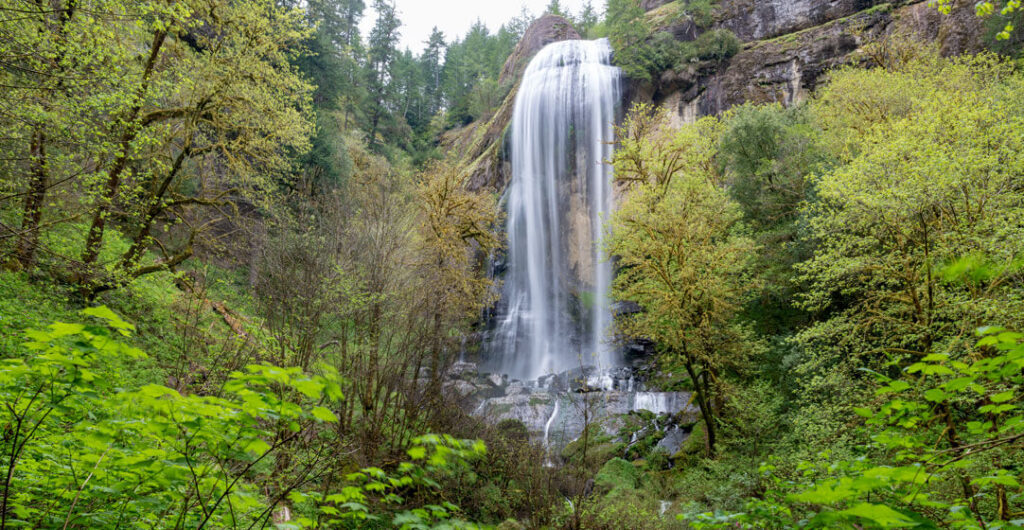
Golden and Silver Falls
The combination of two distinctively different waterfalls and a one-of-a-kind historic trail makes the trek to Golden and Silver Falls, about 25 miles northeast of Coos Bay via Highway 241 and E. Fork Road, another enticing reason to head to the Coast Range. There are a handful of options. The path to Golden Falls crosses a small footbridge before forking right and leading through an impressive grove of Oregon myrtle to the base of the 250-foot falls.
Another trail parallels the creek, through a forest of old-growth Douglas fir and colossal bigleaf maples that highlight the walk with yellow in fall, before arriving at Silver Falls. The 220-foot cascade spills over a rounded dome of bedrock in mesmerizing, individual strands of water that dance briefly through mid-air before reconvening at the bottom. The trail that leads to the top of Golden Falls was once a harrowing road that connected a settlement above the cascade with the valley below. What was surely at one point a white-knuckle journey on wheels, now affords luxury-box views of the falls, as well as an all-encompassing view across the creek-carved canyon.
Easy to moderate 3.1-mile round-trip hike, with 500 feet of elevation gain, to Golden Falls. Shorter are options also available.
–Written by Adam Sawyer, last updated in September 2022.


