Take a Unique Trek through Washington’s Westernmost Point
This one-of-a-kind hike through meadows, forest and along the beach of the Ozette Triangle enables visitors to explore the traditional home of the Makah Tribe and set foot on Cape Alava, the westernmost part of the Lower 48.
People have always been drawn to nature’s extremes: the tallest mountains, deepest lakes, the furthest reaches. Ozette Triangle at the Olympic Peninsula, Washington, enables visitors to set foot at Cape Alava, the westernmost point of the Lower 48, on a day hike beneath iconic Northwest behemoths, through booming meadows and beside stunning seascapes.
All this in a land the Makah Tribe has called home for several millennia, where a landslide buried a large portion of a Makah village about 500 years ago. Covered and preserved by the mud, entire longhouses remained hidden — known only in tribal stories — until a Pacific storm uncovered the site and caught the attention of a hiker in February 1970.

Unlike so many archeological discoveries around the world, the more than 55,000 items recovered here never left the tribe. For 11 years, archeologists worked with the Makah Tribe, which opened the world-renowned Makah Cultural and Research Center in Neah Bay to study and exhibit history saved by time and mud. The discovery confirmed Makah oral history of a “great slide” and helped tribal members connect with their roots.
“It supported what our elders had told us about our history,” says Janine Ledford, executive director of the Makah Cultural and Research Center. “Almost every school kid got to visit the site and see firsthand what had been made by our ancestors.”
She was one of the young tribal students who visited the dig and learned about the Makah’s specialied technology and social hierarchy. As artifacts were recovered from individual homesites, tools and other household belongings showed some families were whale hunters, others were seal hunters and still more fished for halibut. The best artifacts from the Ozette dig are on display at the cultural center’s Makah Museum, including beautiful basketry pieces replicated by Ledford, who still weaves cedar bark baskets in her spare time.
Visiting the Makah Cultural and Research Center and the public areas around the dig site, and the Ozette Triangle in Olympic National Park are ways to immerse yourself in this special place, experience timeless wonders of the Northwest and come face-to-face with human history.

From Lake Ozette to Crashing Surf
For some visitors to this corner of the country, the destination is the crystal water of Lake Ozette, a paddler’s paradise and angler’s haven with various species of fish, including bass, trout, kokanee, sockeye and coho salmon.
But for most who trek to the remote northern shore of Washington’s largest unaltered lake, Lake Ozette is the starting point of a hike unlike any other. Most Northwest hikes offer lakes, forest or beach — maybe two of the three. However, the exceptional Ozette Triangle loop trail runs from a tranquil lake to a place where deep forest and dramatic ocean collide, at one of the nation’s most extreme points on the globe and the site of one the great archaeological finds of our hemisphere.
The Ozette Triangle is roughly equilateral with three segments close to three miles each. The trail never rises more than 150 feet above sea level and the loop can be completed in about four hours without stopping. To fully appreciate the sounds, the sights, the history and the culture, hikers usually plan on eight hours to maximize the experience.
Your first choice on the trail from the Ozette Ranger Station and over the Ozette River is whether to take the Sand Point Trail to the left or take the path to the right toward Cape Alava. Both ways will take you to the beach on gently rising and falling cedar plank boardwalks, but heading to Cape Alava first will put your fresh legs to work on the slightly more strenuous section. The boardwalks can be slippery when wet or frosty, so wear soft-soled sneakers or walking shoes instead of hiking boots that have hard lug soles.
Everything changes along the trail to the ocean: the surface, the surroundings and — most profoundly — the sounds. Chirping birds are replaced by crashing surf, rhythmic boardwalk staccato transitions to crunching sand and the subtle “Ooh, ahs” in the forest become “Oh wows” at the shore when hikers spy a seal, a bear and her cubs or the spout of a passing whale.
The end of the boardwalk is like walking through the gates of one world into another, from forest to ocean, from green to blue. You’ve reached the rocky shores of Capa Alava.

To the Edge of the Lower 48
About 200 yards north of Cape Alava, a bronze plaque marks where the Makah village of Ozette thrived for centuries before the mudslide struck. Little evidence of the dig remains today. Further north is the Makah Reservation and Cape Flattery, the northwesternmost point in the contiguous U.S.
The 3.1-mile beach leg of the Ozette Triangle from Cape Alava to Sand Point takes the longest to navigate not only because the surface is rock and sand instead of boardwalk, but because you’ll want to explore tide pools and all the beach has to offer. And if you don’t check the tide tables, you might need to use the ropes to go over two headlands at high tide, but don’t fret: they’re well marked and easy to navigate, but will add time. You can always turn around at the beach and return the way you came if you’d prefer a shorter hike.
Sea stacks jut out on the coast while an Audubon list of birds more than 50 deep congregate on land and at sea. About a mile south from Cape Alava are the Wedding Rocks petroglyphs. These images of whales, people and even a passing ship of unknown origin have withstood wind, rain and battering surf since they were carved approximately 200 to 500 years ago.
The Pacific churns up treasures for beachcombers with regularity. Glass balls from Japanese fishing nets wash up on rare occasion but not as often as they used to, says John Anderson, a Forks resident who has filled his yard and a 40-by-80-foot building with items collected on the shore. Many of his finds come from this stretch of beach thanks to the way the currents, the offshore islands and Cape Alava trap flotsam and jetsam.

A Walk Through the Forest
The final section of the Ozette Triangle is the 2.8-mile walk back to Lake Ozette. Hemlock, cedar and Sitka spruce stretch for the sky above while a potpourri of huckleberry, salal and ferns grow beyond the cedar boardwalk planks.
Rob Snyder, who began visiting the area in the late 1970s, says he once hiked the triangle 90 days in a row. Seduced by the aura of the forest and the power of the Pacific, he left the sunshine of the American Southwest for one of the wettest, darkest spots on Earth, where he built a store, a home and a campground.
“I never tire of the sound and fury of the pounding surf. You can hear it 3 miles from the ocean,” Snyder says. “And then there’s Lake Ozette: 8 miles long, with rarely more than a dozen boats on it, with a million stars above in the night sky and a straight-on view of the glaciers on Mount Olympus by day.”
With every step bringing you closer to where you started, the last stretch of the Ozette Triangle might put you in a contemplative mood. Where better to reflect on the eternal march of time, the raw potency of the Pacific and our place in all of it?
–Written by John Deleva, last updated in October 2022.
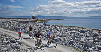
–The top photo is a view of Ozette Island. Photo is by Diana Robinson Photography/Getty Images.