See Alaskan Beauty on the Road
A trip down the Seward Highway reveals massive glaciers, belugas and a supernatural tidal wave.
It takes a special kind of person to surf the Turnagain Arm bore tide, a rush of incoming seawater that resembles a wall, sometimes 6 to 8 feet tall. This is often the type of person who will shape their life around it: rearranging their daily schedule to catch this natural phenomenon, which can travel as fast as 20 mph when conditions — including a combination of wind and current, along with a full or new moon — are just right.
“When a bore tide appears, it sounds like a jet engine,” says Alaska native Kerry Tasker, an editorial and commercial photographer who’s spent about four years photographing Turnagain Arm’s surfers. It’s also fast and turbulent.
“Most people who try it for the first time fall down immediately,” says Tasker. “Even if they’re experienced surfers.” Bore tides only happen twice a day, usually a couple of hours after low tide. However, it’s during extreme minus tides (when water levels are especially low) that the most dramatic bore tide waves occur. If the wave knocks a surfer down or they miss it, they’ll then have to wait 12 hours for the next one. But hit it just right and they can catch a ride for up to 15 miles up this long and narrow waterway.
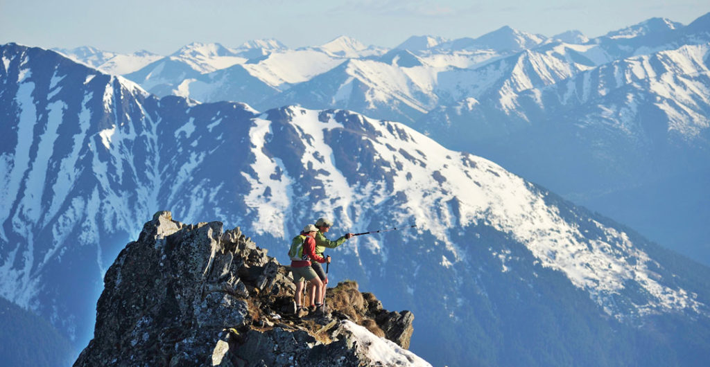
While there are bore tides in other places — France, Brazil, Indonesia — Alaska’s is special. Not only is it the northernmost bore tide on the planet, with water temperatures consistently at a bone-chilling 40 to 50 degrees Fahrenheit, it also features the spectacular Chugach Mountains rising up thousands of feet as its backdrop.
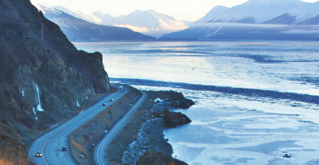
However, surfing Alaska’s bore tide may not even be a sport if it weren’t for the Seward Highway, a 127-mile National Forest Scenic Byway that winds from Anchorage to Seward, passing fresh and saltwater marshes, gushing waterfalls and even what’s known as a “ghost forest,” tree remnants that are a stark reminder of the region’s 1964 earthquake. There’s also Turnagain Arm, which straddles the highway for its first 50 miles. This proximity allows surfers to park their cars alongside the Arm, set out on a paddleboard (the best way to surf the bore tide) during low tide and then surf the tidal bore back.
Turnagain Arm is undoubtedly one of the highway’s biggest attractions, especially throughout summer. In these warmer months, the Pacific salmon run is in full swing, attracting dozens of beluga whales to feast, and hundreds of visitors keen on watching. There also are a larger number of surfers, along with kayakers and kite-surfers who come to brave the bore tide while avoiding the Arm’s treacherous mudflats — glacier silt that can suck you in like quicksand. Once autumn hits, the crowds lessen, although the scenery remains just as spectacular. Not just along Turnagain Arm, but the entire Seward Highway as well.
Anchorage to Girdwood
The Seward Highway travels southeast from Anchorage, Alaska’s largest city, making its way past the Anchorage Coastal Wildlife Refuge: a 16-mile stretch of marshes, tidal flats and swampy boglands brimming with alder trees, and at its southernmost point, Potter Marsh. Birders are especially drawn to this accessible wetland, home to wandering moose and swimming muskrats, to catch sight of its many migratory species. Red-necked phalaropes, northern harriers and canvasback ducks (known for their diving prowess) stick around through late September.
From Porter Marsh, the highway skirts the southern portion of Chugach State Park. At nearly a half-million acres, Chugach is one of the country’s largest state parks, encompassing everything from massive glaciers to soaring peaks ripe with opportunities for hiking, mountaineering and cross-country skiing. There’s also ample wildlife, including brown bears, black bears, moose and mountain goats. Snowshoe hares are regular visitors during colder months, meaning lynxes — their natural predators — are never too far behind.
Across the highway is Turnagain Arm. Guardrails protecting against sheer drop-offs are good reminders to keep your eyes on the road. Thankfully, there are numerous viewing points for drinking in the scenery. These include Beluga Point (milepost 110), perfect for catching both its namesake cetacean and bore-tide surfers in action. There’s also Windy Corner (milepost 106), one of the highway’s best spots for viewing Dall sheep on the roadside cliffs. A good pair of mini binoculars is a must.
Stands of birch and spruce trees give way to temperate rain forest as the road passes Bird Valley. Bird Point (milepost 96) is another viewing area where every direction offers something to see. This includes Penguin Ridge, a mountain crest where visitors often spot Dall sheep and mountain goats.
“It’s one of the few places on Turnagain Arm where these two species mix,” says Chugach park ranger Thomas Crockett.
Tucked among a mossy forest of Sitka spruce and western hemlock trees is Girdwood (milepost 90), a mountain town that’s an ideal pit stop. With 76 named trails, including North America’s longest continuous double-blackdiamond ski run, Girdwood’s Alyeska Resort attracts skiers and snowboarders of all levels. Dog sledding with Alaskan Iditarod huskies and trails and meadows for snowshoeing also abound, while in summer, outdoor enthusiasts take advantage of downhill mountain biking and hiking. This includes the 3-mile-long hike-or-bike Winner Creek Trail, a rainforest meander that bridges a blue-water gorge, then connects to a hand-cranked metal tram that hangs above Glacier Creek. For a less
strenuous, yet equally thrilling, activity, hop aboard the Alyeska Aerial Tram, which climbs to 2,300 feet for prime views of hanging glaciers.
Pick up Alaskan-made souvenirs at the Girdwood Center for Visual Arts, a long-standing, artist-run co-op that showcases the works of nearly 30 Alaska artists, all of whom volunteer here. Art ranges from metalsculpted display orbs made from recycled chains and bolts, to hanging fabrics showcasing Alaskan scenes, like king-crab fishing and kayaking. At the neighboring Bake Shop, savor a legendary lemon-glazed sweet roll while mulling over potential plans.
Girdwood to Seward
The Seward Highway continues from Girdwood, encountering the Chugach National Forest: nearly 7 million acres of salmon- and trout-filled streams, tidewater glaciers and evergreen woodlands, not to mention thousands of bald eagles. It’s also home to Portage Valley, a narrow 14-mile strip connecting Alaska’s mainland to the Kenai Peninsula below.
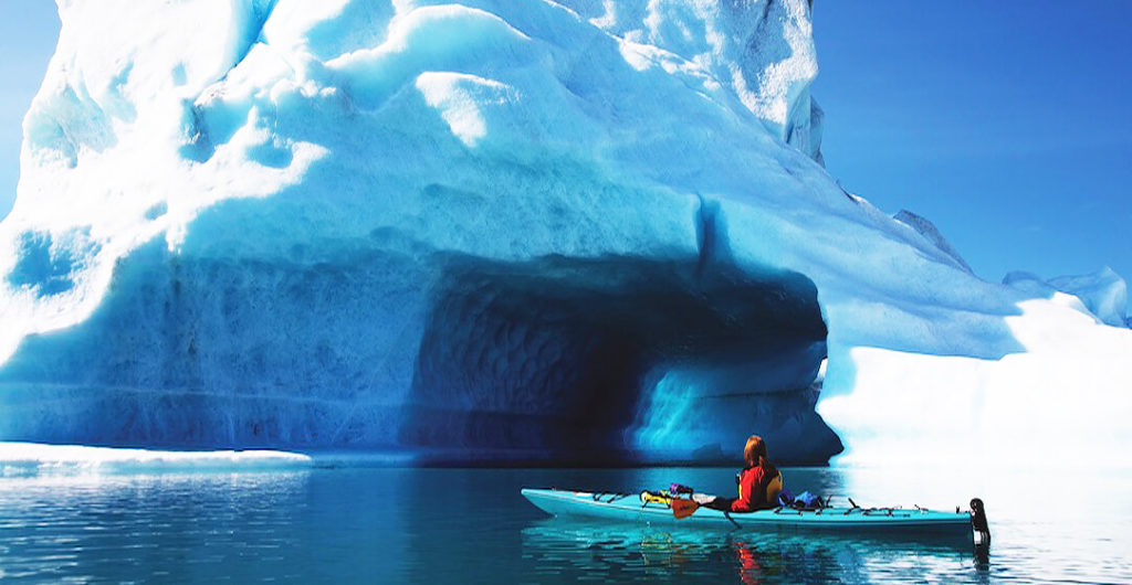
Here, visitors can view rescued resident wildlife, including muskox, reindeer and wolves in their natural habitats at the 200-plus-acre Alaska Wildlife Conservation Center. Another highlight is Portage Glacier. Despite being in retreat and no longer visible from the highway, a boat ride across Portage Lake, known for its floating icebergs, provides up-close views. During winter, more intrepid types often cross the lake on foot, skis or fat-tire bikes. There’s also nearby Byron Glacier, known for its ever-forming ice caves.
The Trail of Blue Ice, a mostly flat 5-mile hiking and biking trail with bridges and boardwalks, connects the two glaciers. It’s also a prime spot for black bear and moose viewing, along with colorful purple and yellow wildflowers each spring.
From Portage Valley the highway turns west, leaving the Anchorage bowl and continuing along the Kenai Peninsula. The road reaches its highest point at the subalpine setting of 900-foot-high Turnagain Pass (milepost 68). Thirteen miles later, it encounters the Hope Highway, a turnoff for the once-booming Gold Rush town of Hope. This bucolic community is worth the detour, with opportunities for gold panning and a historic mining museum to explore.
The small lakeside village of Moose Pass and its Drop-in Trading Post, with more than two dozen flavors of homemade fudge, are a highlight en route to Seward, the highway’s end point. This cruise ship port city is also the southern terminus for the Alaska Railroad’s main route (a wonderful Seward Highway alternative), as well as gateway to the glacier-filled Kenai Fjords National Park.
Read more about the best times to travel to Alaska.
– Written by Laura Kiniry, last updated in October 2022.
– Top image is of the Turnagain Arm by Design Pics Inc./Alamy.

