Discover the Many Wonders of the Islands’ Volcanoes
In the middle of the Pacific Ocean, hundreds of miles from any other land, lies the row of islands known as the Hawaiian Archipelago. The islands are the summits of a massive oceanic mountain range that rises from the ocean floor; some, in the northwestern part of the chain, are barely above sea level, while Mauna Kea on Hawaiʻi Island in the southern end is taller than Mount Everest, rising nearly 33,500 feet from its base on the sea floor.
How did they form?
The eight Hawaiian Islands were created by volcanoes, which began to form more than 70 million years ago. And of the 161 potentially active volcanoes in the U.S. from Alaska to New Mexico, Hawaiʻi has one of the most active. Kīlauea on Hawaiʻi Island — home to four of the state’s six active volcanoes — erupted almost continuously from 1983 to 2018, when lava spewed more than 100 feet into the air and molten rivers destroyed over 700 homes in nearby Puna. (Kīlauea began erupting again in September 2021, although lava activity is confined within Halemaʻmaʻu Crater in Hawaiʻi Volcanoes National Park.)
That kind of destruction rarely happens, and the rest of Hawaiʻi’s volcanoes are not that active, if at all. Wind, rain and catastrophic prehistoric landslides shaped the volcanoes into dramatic peaks and valleys, and the Islands’ beaches boast various colors, from volcanic black sand to olivine green. So everywhere you look in Hawaiʻi, you’ll see parts of the Islands’ dynamic geological history.

OʻAHU
The island of Oʻahu — the state’s most populated with around 1 million people — was formed by two main volcanoes: Waiʻanae and Koʻolau. Both are more than 2 million years old and considered extinct. These volcanic mountain ranges divide the island. The Waiʻanae Range is 22 miles long and 9 miles wide on the northwestern side of the island; it has the tallest peak on Oʻahu, Mount Kaʻala, at 4,025 feet. The Koʻolau Range, beloved for its dramatic serrated pali (cliffs) that rise abruptly on its eastern side, runs for 37 miles along the island’s eastern coast. Lēʻahi, aka Diamond Head, is a tuff crater 760 feet above sea level. This iconic natural landmark was caused by a single, explosive eruption about 300,000 years ago.
Ways to Explore
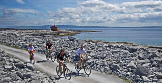
Some of the island’s most popular hikes are along the Koʻolau Range. One of the easiest trails to the summit is Kuliʻouou Ridge Trail, a 5-mile state-run hike with gradual switchbacks, shady paths through groves of ironwood trees and Cook pines, and a trek up 300 steps (installed to prevent erosion) to the top, with a nearly 360-degree view of the island. You also can snorkel in a flooded crater.
Diamond Head is another popular hike. The 1.6-mile trail to the summit of this broad, saucer-shaped crater was built in 1908 as part of Oʻahu’s coastal defense system. At the top you’ll be greeted with panoramic views of the island’s southern coastline, from Waiʻanae to Koko Head. You can snorkel in a flooded crater. Hanauma Bay was created about 32,000 years ago in a violent series of explosions. Waves eroded one side of the crater rim, creating this unique natural aquarium.
As you walk down to the bay, you can see fragments of white coral limestone and dark basalt rock embedded in the walls of tuff. Sometimes you can find small crystals of olivine — a beautiful green silicate mineral — in the sand. In the bay you can see thousands of tropical reef fish—butterflyfish, tang, wrasse, moorish idol, goatfish, bluefin trevally and the state fish, a reef triggerfish called humuhumunukunukuāpuaʻa.

HAWAIʻI ISLAND
This is where the action is. Even the ancient Hawaiians told moʻolelo (stories) about the volcanoes here, legends about Pele, the goddess of fire and volcanoes, who lives in Halemaʻumaʻu Crater at the summit of Kīlauea. The first recorded history of volcanic activity in the Hawaiian Islands was in 1823, when an English missionary visited Kīlauea Crater and witnessed gas rising from the vents of the lava flow. Today, the U.S. Geological Survey’s Hawaiian Volcano Observatory monitors six active volcanoes in Hawaiʻi, four of which are on Hawaiʻi Island, the chain’s youngest and therefore most active. More recently in late 2022, Mauna Loa began spewing lava, causing a rare dual eruption on the island.
The Hawaiian Islands sit on the middle of the tectonic Pacific Plate that’s moving 2 to 4 inches a year over what’s called a hotspot, a place where magma rises upward until it erupts on the seafloor. Right now, this hotspot is lurking below Hawaiʻi Island, fueling the eruptions of Kīlauea, Mauna Loa (the largest active volcano in the world), Hualālai and the submarine volcano Kameʻehuakanaloa (formerly Lōʻihi Seamount). Mauna Kea, a shield volcano that hasn’t erupted in 4,000 years, is the highest peak in the state at 13,803 feet above sea level. When measured from the sea floor, it’s the tallest mountain in the world at 33,497 feet. (Mount Everest stands at 29,032 feet above sea level.) In winter months it’s not uncommon to see snow at the summit of this sacred mountain.
Ways to Explore
Kīlauea is still active — and accessible to visitors. The volcano is part of the 333,308-acre Hawaiʻi Volcanoes National Park, where you can hike across the desolate crater floor of Kīlauea Iki, the site of a spectacular eruption in 1959; gaze at the 90-foot-tall Hōlei Sea Arch, which was cut into a cliff of an ancient lava flow about 550 years ago; or check out Haʻakulamanu (sulphur banks), where volcanic gases seep out of the ground along with groundwater steam. (Nāhuku, or Thurston Lava Tube, was closed for repairs at press time.)
Of course, the jewel of the park is Kīlauea, and viewing the current flow is doable and safe. Right now the eruption is contained within Halemaʻumaʻu Crater, and it has created an immense lava lake visible from many areas and overlooks in the park. One spot is Uēkahuna, the bluff near the former Jaggar Museum. There’s lots of parking, and the walk to the lookout is paved and short.
A better — yet more crowded — option is the overlook near Keanakākoʻi Crater. Park at the Devastation Trail parking lot, then walk about a mile over mostly paved terrain to the lookout, where you can see the lava lake and sometimes lava fountains. It is best to go in the evening or early morning to catch the glow from the lava. Remember that in Hawaiʻi an eruption is considered a sacred event. Be respectful while visiting. Bring warm clothes, flashlights, water and sturdy shoes.

MAUI
Although the most famous volcano on Maui is Haleakalā, the island is actually made up of two. Mauna Kahālāwai, or the West Maui Mountains, is an eroded volcano characterized by steep slopes, deep valleys and home to a diverse array of native species, including at least 18 plant species endemic to this mountain alone. This volcano is about 1.7 million years old, last erupting more than 300,000 years ago. Haleakalā, however, rose from the ocean 1 million years ago and has witnessed at least 10 eruptions in the past 1,000 years. The size of this massive shield volcano — 10,023 feet tall and spanning 570 square miles — forms more than three-fourths of the island. It’s the only active volcano on Maui.
Ways to Explore
The only way to explore Haleakalā is by visiting 33,265-acre Haleakalā National Park. Just the drive alone is a science experience. You’ll pass through as many ecological zones on a 2-hour drive from the coast to the summit. The volcano is home to more endangered species than any other national park in the U.S., including the ʻāhinahina, the native silversword only found at the summit area, and the ʻākohekohe, an endangered crested honeycreeper that only lives in pristine native forests above 5,000 feet in elevation.
The most popular attraction at the national park is viewing the sunrise (or sunset) at the summit (reservations are required). The park’s Kīpahulu District — 12 miles past the remote town of Hāna — is worth exploring. The moderate 3.4-mile Pīpīwai Trail meanders through towering bamboo forest and ends at the 400-foot Waimoku Falls.
—Written by Catherine Toth Fox
—Top photo is by Shane Myers Photo/Adobe Stock.
This article appears in the Winter 2023 edition of AAA Washington’s member magazine, Journey.
Born and raised on Oʻahu, Catherine Toth Fox has been a freelance writer and editor for more than 20 years. She has worked as a newspaper reporter in Hawaiʻi for 10 years and continues to freelance — in between teaching journalism, hitting the surf and eating everything in sight — for national and local print and online publications. She lives in Honolulu with her husband, son and three rescue dogs.